C-09 · Original · 2026-10-01
Jatduru Mountain Huts
Fictional mountain huts
Booking site for hikes with elevation and open beds at 6 shelters, plus distance and elevation profiles for 8 routes
How it was made
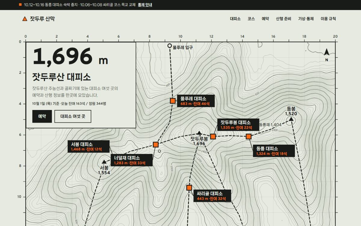
The screen is built on a contour topographic map. A fictional mountain was constructed from 7 ridge lines and noise to create a height field.
Contour lines, shelter elevations, and route distance, ascent and elevation profiles are all calculated from this height field.
No numbers are entered by hand, so the map, tables and profiles stay consistent.
Shelter names are styled as trail signposts. Elevation and distance figures are set larger than the titles.
Travel time is calculated from distance and ascent, and the formula is shown on screen.
Booking runs in this order: shelter, October calendar, headcount and blankets, route, booker. It shows the latest departure time based on route duration.
The screen states that the mountain and figures are fictional and that bookings are not sent.
Key features
- Shelter filter & sort
- Route elevation profile · map path
- Open-bed calendar booking · departure time calculation
- Packing checklist · temperature by elevation
Where and how to use it
Fits places that take date-based bookings for lodging or facilities with a fixed number of spots. Condition comparison, open-bed calendar and packing guide are linked.
Industries
- Mountain lodges, campsites & forest retreats
- Activity program operators
- Local tourism guides
Reusable screens and features
- Open-bed calendar
- Condition filter + map
- Travel time calculation
- Packing checklist
Points to check
No real booking system or live availability integration.
After reading the document
The live site opens in a new window.
Go to site(opens in new window)